
The Air Force Museum’s photographic collection is enormous and significant – dating back to before World War Two. In this blog, Keeper of Photographs Matthew O’Sullivan explains how the collection of aerial photos works and what’s on offer.
The Air Force Museum of New Zealand holds a very large photographic collection. Most are original negatives from the RNZAF Official series, dating from before World War Two up until they began using digital cameras around 2000.

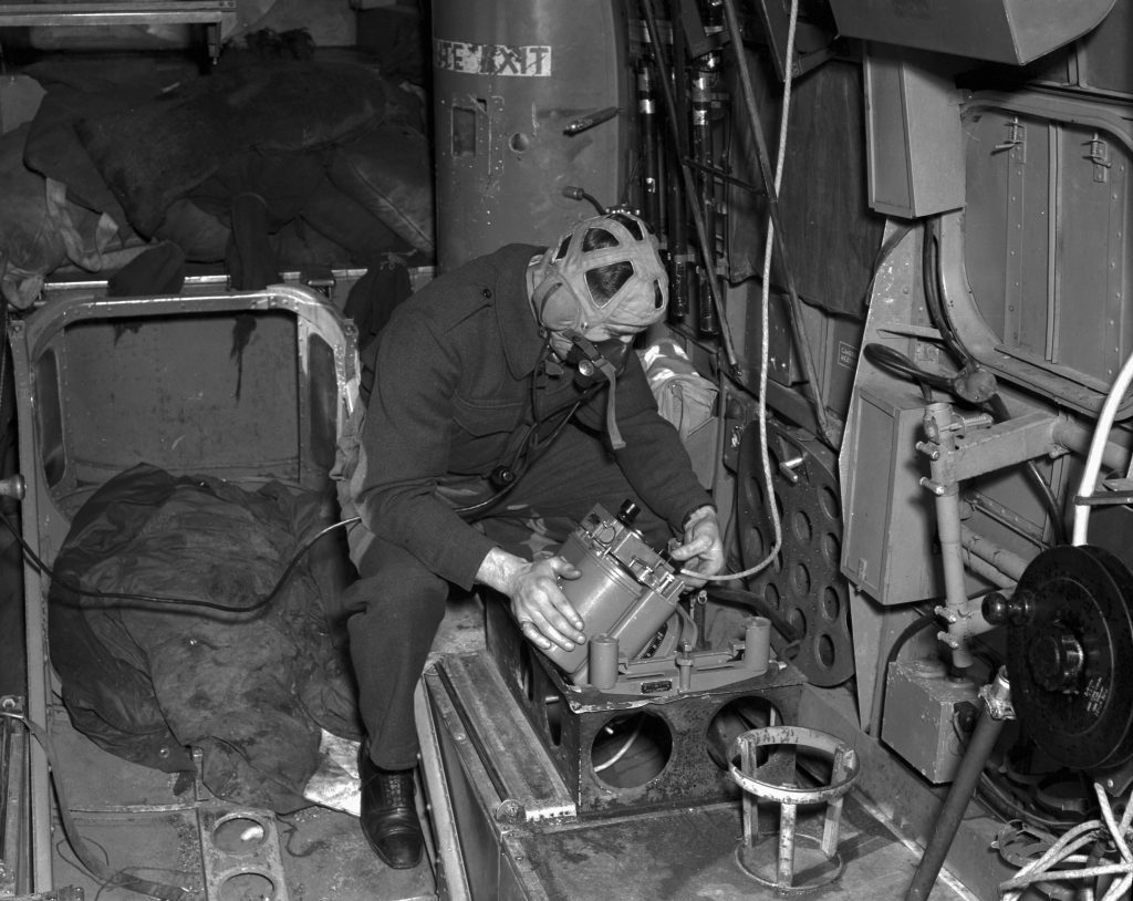
Image: RNZAF Official PR62
The museum’s searchable online database of digital images is called Fotoweb and is free to download. At the point of writing we have 46,000 images are available to the public, out of an estimated 800,000 to one million images in the collection.
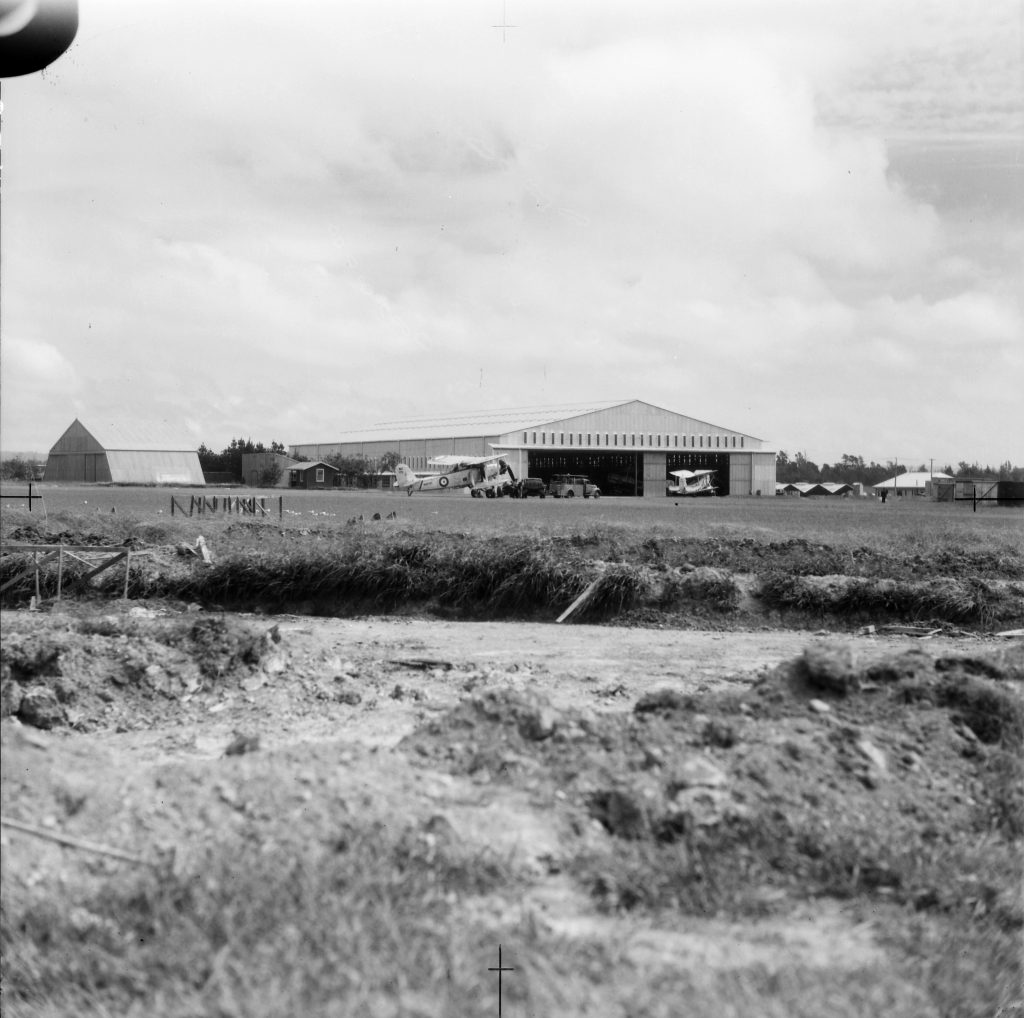
RNZAF Official WhG2554-44
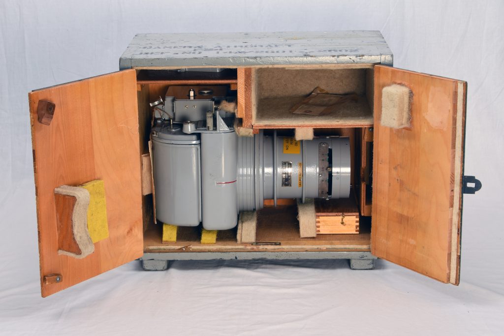
A significant portion of the undigitised collection consists of aerial photographs. The RNZAF began aerial surveys of defence sites before World War Two. After the war several aerial survey companies started the work but the RNZAF continued taking aerial photos for its own purposes and sometimes, for other Government departments.
Image: RNZAF Official OhTin62frameC199
Photos include off-shore territories from as far south as the Auckland Islands, to as far north as Tokelau near the equator.
Original negative registers are held for much of the collection, but these often only have information such as date and broad coverage. They knew what they meant at the time! Often though, there can be some gems hidden on a roll of aerial film and are not even mentioned in the register.
RNZAF Official WhTin96frame61
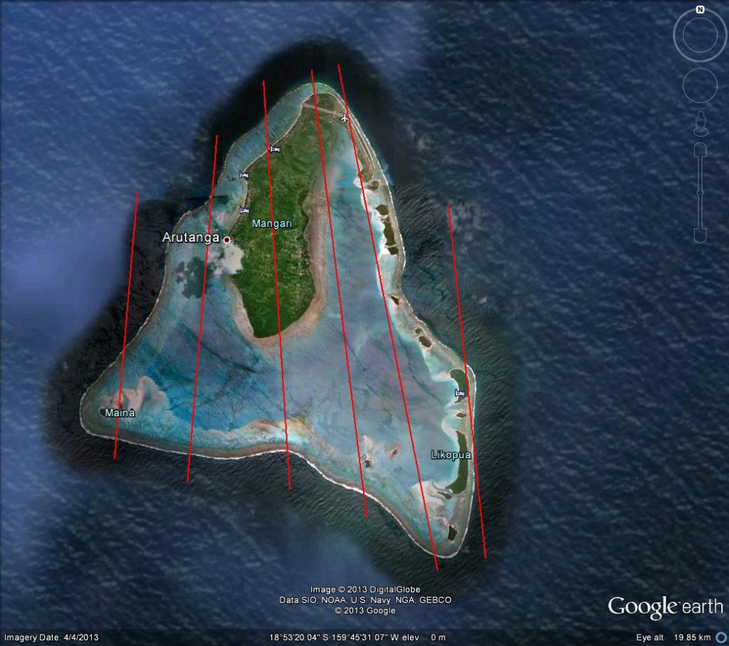
Much of this part of the collection remains un-catalogued, undigitised and un-accessed. Some now have basic information recorded. This is usually a plot of the centre-line of each run. We put this into Google Earth and save the resulting .kmz files, which are tiny and can be emailed to researchers to give them an idea of coverage.
This approach is not so well suited to oblique views- photos taken at an angle to the ground, as opposed to vertical to the ground. Usually these will be either digitised and up-loaded to the database or noted and left un-digitised.

Image: RNZAF Official WgF22
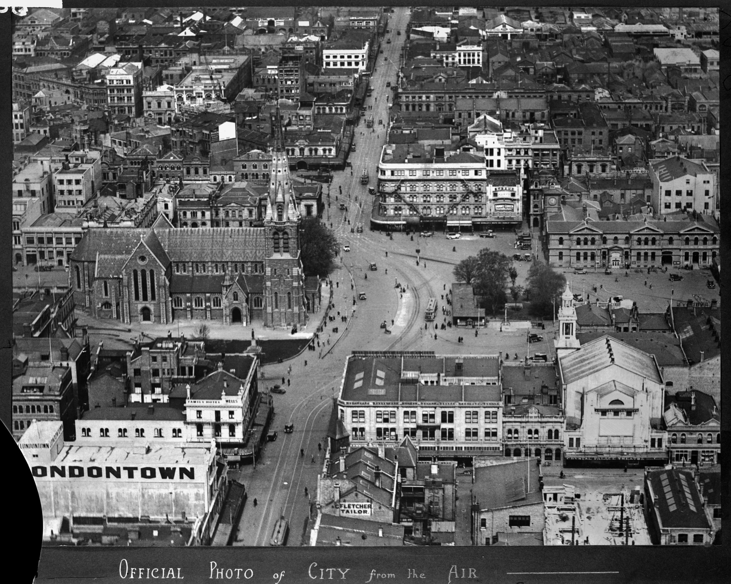
Vertical surveys were frequently used by cartographers to draw topographic maps. This was achieved by making each frame in a run overlap by at least 60%. When viewed with the proper equipment these images become 3D, with accentuated vertical heights.
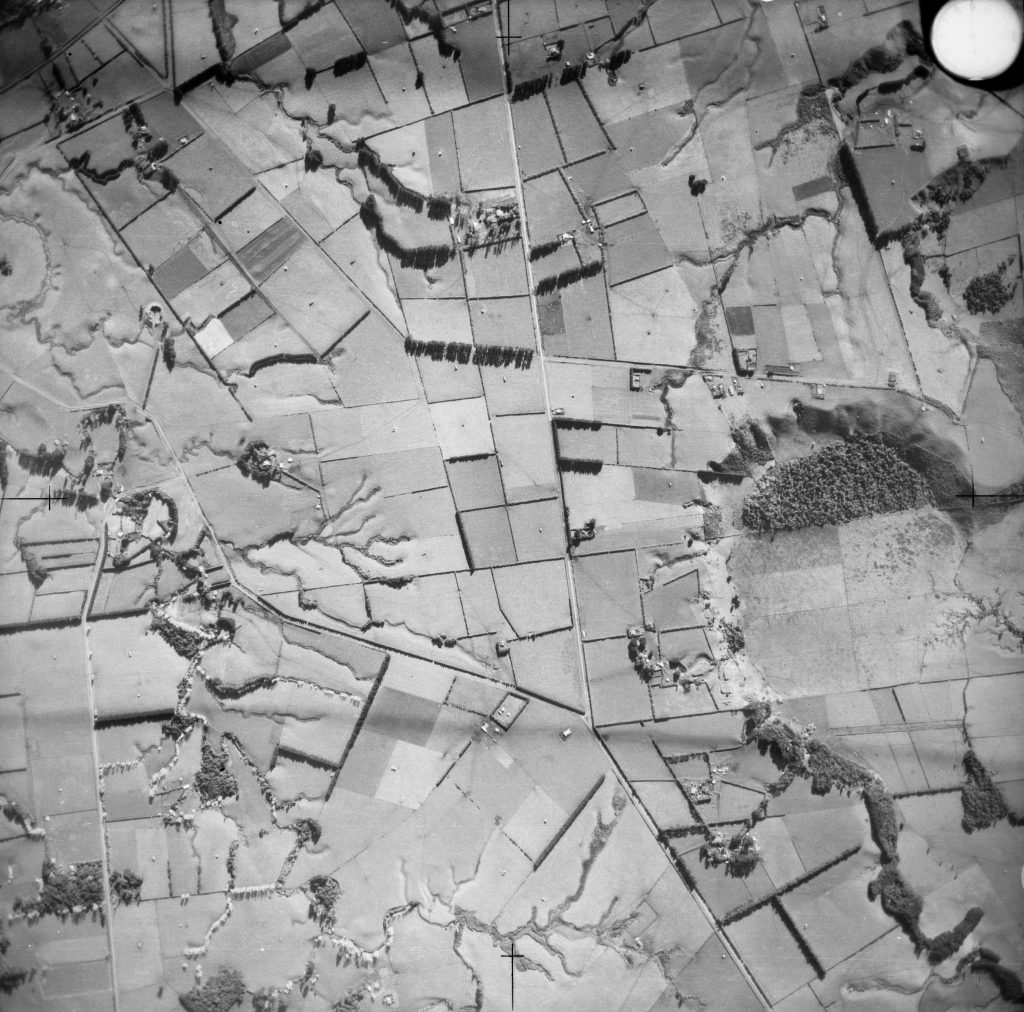
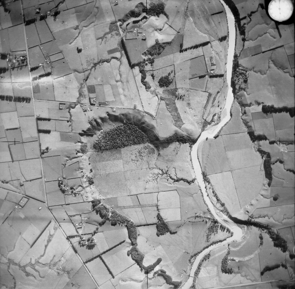
These two frames giving a stereo overlap of an area north of New Plymouth. The ear-shaped depression shows the extent of overlap. 8 June 1943. They are RNZAF Official NpTin28frameD469 (left) and NpTin28frameD470 (right).
In the latter part of the 20th Century, the aerial films contain images of search and rescue missions in the Pacific and Exclusive Economic Zone Patrols that were carried out by No. 5 Squadron in their Orion aircraft.
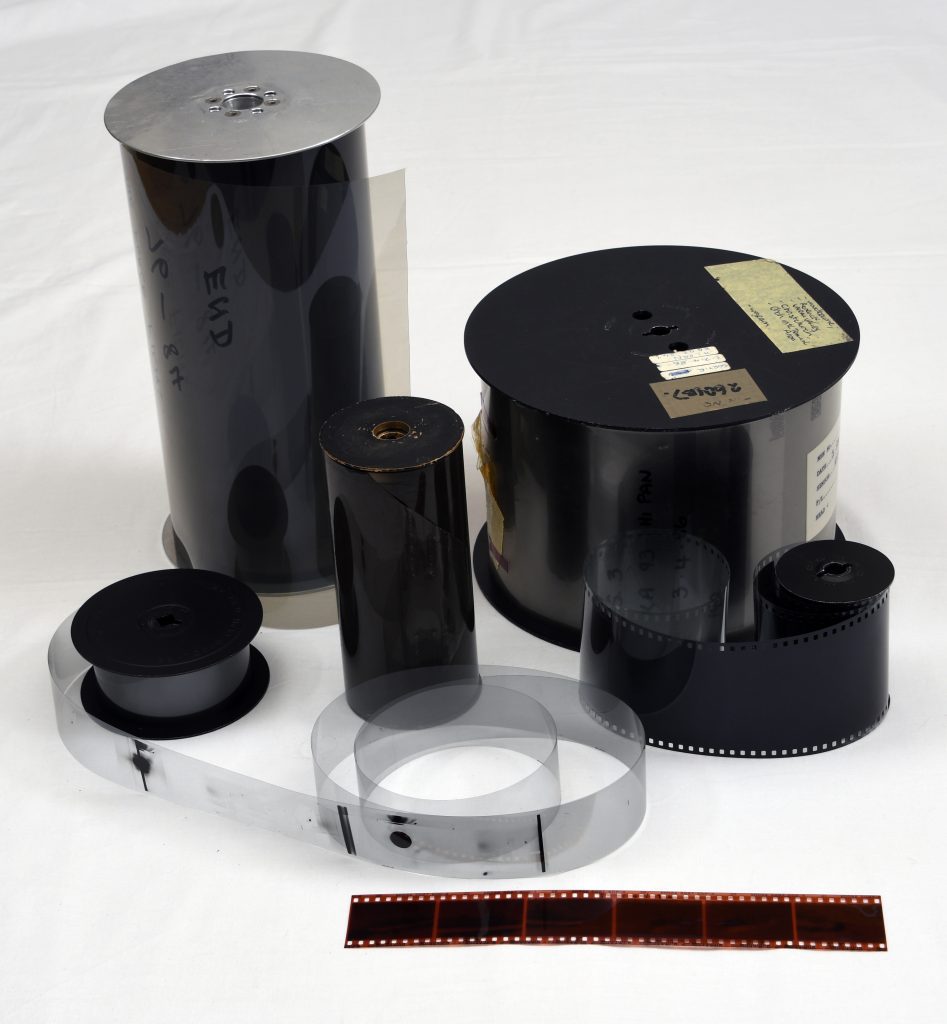
Aerial film in the collection can range in size from approximately 6 cm wide to 24 cm wide! Other air forces used film and cameras triple that size!
The Department of Conservation, Historic Places Trust and regional councils, among others, have accessed aerial photos. Unfortunately we cannot guarantee that we have photos of every part of New Zealand!
For enquiries about aerial film holdings please contact research@airforcemuseum.co.nz

