Our Research Team receive all kinds of public enquiries, and the questions we’re asked can lead us on some interesting paths – and even on mountain treks! This is the story of a Kiwi airman whose wartime reconnaissance photographs helped develop the safer, second route to the summit of Mount Everest.
Earlier this year the Research Team was contacted by an American academic, working with another physician to create an archive on high altitude medicine. In particular, our researcher was investigating the development of the second route to Mount Everest’s summit (the route from Nepal used by climbers today) – and the role of New Zealand Squadron Leader Clifford Grainger Andrews DFC in this important period in Himalayan exploration.
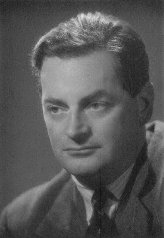
Who was Squadron Leader Andrews?
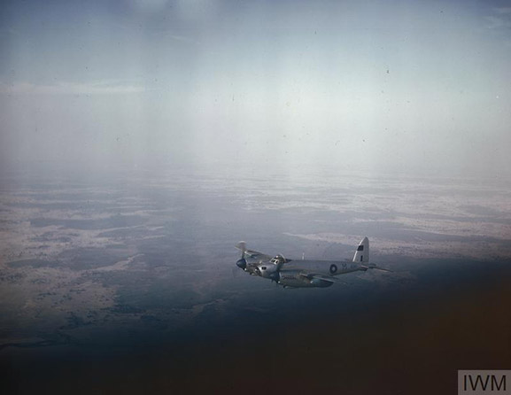
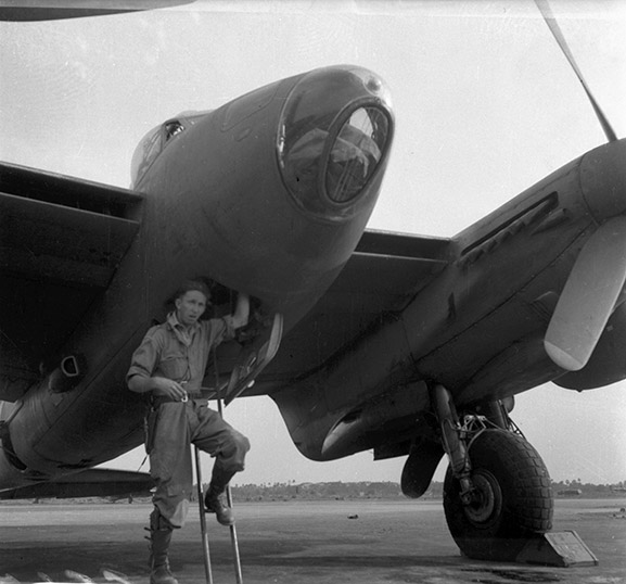
Dunedin-born Andrews worked as a draughtsman before joining the RNZAF on 4 September 1939. He previously flew Hudsons in the Pacific, later flying Mosquitos with No. 684 (photo-reconnaissance) Squadron RAF in South East Asia. During this time, Andrews performed a forced landing at Kallang on 31 August 1945, and became the first New Zealander (and first Allied aircraft) to land at Singapore after the Japanese surrender.
The photograph below from our collection shows Andrews (then Flight Lieutenant) exiting a No. 684 Squadron de Havilland DH98 Mosquito, somewhere in India, circa 1945:
While Andrews’ entry in By Such Deeds mentions his flying over Everest in a Mosquito aircraft in July 1945, it gives no further details of this flight. It does however include the citation for his Distinguished Flying Cross, received 17 August 1945 [No. 684 (photo-reconnaissance) Squadron RAF (Mosquito)]:
‘Throughout a large number of photographic reconnaissances this officer has displayed a high standard of skill, enthusiasm and devotion to duty. On one occasion after a flight of over 8 hours duration one engine of his aircraft failed. With great coolness he executed a masterly landing, after dark, with only 10 gallons of fuel available.’ [1]
But we are fortunate to have Andrews’s flying log books in our collection, and as official records of the flights he flew, these artefacts provide the exact dates of the two flights he made over Everest: 16 June and 1 July, 1945.
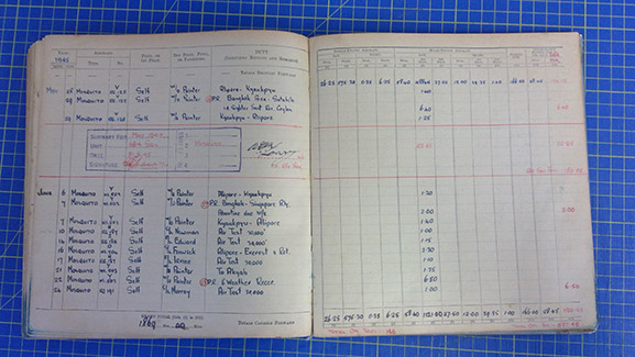
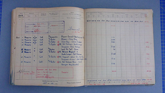
Log book entries of Squadron Leader Clifford Grainer Andrews’s 1945 Everest flights from his pilot’s flying log book, covering training and wartime service in New Zealand, Fiji, England and South East Asia, 1939-1946. Image from the collection of the Air Force Museum of New Zealand.
You will notice these entries don’t give any indication of the purpose of these unofficial flights. The first flight was officially known in the operations room as ‘a high altitude fuel consumption test on a course from Calcutta to Darjeeling and return.’ [2] But in actual fact, Andrews, along with fellow Kiwi Flight Lieutenant Jack Irvine DFC and other squadron members, were photographing Mount Everest using the automatic cameras fitted to their aircraft.
The high altitude version of the de Havilland Mosquito flown by Andrews was ‘accustomed to flying at 25,000 to 30,000 feet on operational work’ and was ‘admirably suited for a flight over Everest’ [3] the summit of which is the highest point on earth, at 8,848 m above sea level.
The archival search for the summit
After Tibet closed its borders in 1950, attention turned to the southern side of the mountain. Pre-war, the Nepalese side of Everest was forbidden to all foreigners; exploration was restricted to the northern side of the mountain. The first Tibetan route was also extremely dangerous and the altitude barrier could not be overcome. [4]
The 1949 Chinese Revolution opened Nepal to exploration, and planning for a British reconnaissance expedition taking the southern route from Nepal soon began.
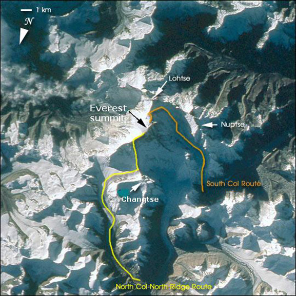
At the time topographical information was very limited. So in 1951, English surgeon, mountaineer, and Royal Army Medical Corps officer Michael Ward began searching the archives of the Royal Geographical Society (RGS) for answers.
There, among other reconnaissance photographs, Dr Ward discovered the photographs taken by Andrews on these unofficial flights over Everest in 1945. These had been ‘given to the photographic archives of the Royal Geographical Society, in early 1951, by geographer Major Bertram Hughes Farmer, who had been an Air Survey Liaison Officer with the army in India.’ [5] It was Farmer who directed the photo-reconnaissance evaluation unit in India examining the photos taken by Andrews’ squadron.
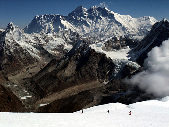
Due to the photographs’ high level of detail showing the northern face of Lhotse and the South Ridge from South Col to the summit, Andrews’ efforts provided important images which allowed Dr Ward to develop the ‘new’ route up Everest from Nepal.
The high-altitude medical problem was resolved by supplementary oxygen research in 1952, and together with the contributions of Squadron Leader Andrews and Major Farmer, plus Dr Ward’s determined research, a route was found through the icefall at the mountain’s base, and in 1953 this led to the successful first ascent of Everest – one of the great achievements of the 20th century.
Everest: in a pilot’s own words
A significant outcome of this research is that the Museum received copies of Dr Ward and P. K. Clark’s 1992 article, ‘Everest, 1951: cartographic and photographic evidence of a new route from Nepal’ published in Geographical Journal (featuring Andrews’s photos) and Andrews’ own account of his flights over Everest, published in Tararua, the annual magazine of the Tararua Tramping Club in 1947.
Demonstrating that same daring human spirit that still draws climbers to the summit today, Andrews and his navigator, Squadron Leader C. Fenwick of England bade the mountain farewell:
‘As a final gesture we decided to fly as close to the very summit as possible … as we approached we closed in, and when the summit flashed past just above our wing tip it was only about thirty feet away. As we crossed the North East Ridge we experienced a terrific wallop from a down draught which took us quite unawares, but we were fortunately well clear. At this sign of impatience from the greatest of all mountains we bade farewell. Reluctantly we curved away and sped towards the south leaving Everest fading into the purple haze, alone in its glory.’ [6]
References
[1] Group Captain C.M. Hanson, By Such Deeds: Honours and Awards in the Royal New Zealand Air Force 1923-1999, Volpane Press (Christchurch) 2001, p.58
[2] C. G. Andrews DFC, “Flight Over Everest” in Tararua: Annual Magazine of the Tararua Tramping Club, No. 1, June 1947, Tararua Tramping Club (Inc.) (Wellington) 1947: 7
[3] Andrews DFC, “Flight Over Everest”: 6
[4] Michael Ward, “The Exploration of the Nepalese Side of Everest” in Alpine Journal, Vol. 97, No. 341, 1992/93: 213
[5] M. P. Ward and P. K. Clark, “Everest, 1951: cartographic and photographic evidence of a new route from Nepal” in Geographical Journal, Vol. 158, No. 1, 1992: 48
[6] Andrews DFC, “Flight Over Everest”: 10
